



Things to Do in Omaha, NE This July

apple-calendar-desk-196650
Table of Contents

Looking for some great events to attend in Omaha this July? You won’t want to miss these!

Music in the Park: Omaha Big Band & Salute to Military Night
When: Wednesday, July 17, 2019, from 6:30 to 8:00 PM
Where: Bayliss Park
100 Pearl Street
Council Bluffs, IA 51503

Part of the six-week series of summer fun in the park, this family-friendly event is the perfect mid-week treat. Bring along a lawn chair or picnic blanket and enjoy the concert. You can also take in the sights at the Bayliss Park fountain and the Veterans’ Memorial Wall, as well as enjoying the interactive water feature and touchable art at the park.

Omaha Zoo
When: Every Wednesday and Saturday from 10:30 to 11:30 AM starting July 20, 2019
Where: Omaha’s Henry Doorly Zoo and Aquarium
3701 S 10th St
Omaha, NE 68107

As one of the world’s best zoos, you can rest assured this bi-weekly event will be enjoyed by all ages. Attendees will get a behind the scenes look the Omaha Henry Doorly Zoo & Aquarium and what it’s like to feed the sharks in Shark Reef.

Omaha Farmers Market
When: Every Sunday from 9:00 AM to 1:00 PM starting July 21, 2019
Where: Aksarben Village
67th and Center St
Omaha, NE 68106

Spend a relaxing Sunday strolling through the Aksarben Village’s farmers market. The market features over 100 vendors and offers plenty of options for fun, fresh food, and family time.

Architecture on Tap
When: Every Tuesday from 5:30 to 7:00 PM starting July 23, 2019
Where: Joslyn Castle
3902 Davenport St
Omaha, NE 68131

Presented by the Joslyn Castle and Restoration Exchange of Omaha, Architecture on Tap celebrates the pillars or architecture and their impact on Omaha. During the weekly event, you can enjoy a cold beer from Infusion Brewing company as you explore the exhibit of historic and contemporary blueprints found on the first floor. There will also be a lecture presented each week by local experts to offer more insight into the city’s historic architecture.

For more events in Omaha and the surrounding area, click here.

About Author
Denny Van Moorleghem
Denny started as a trim carpenter in 1969 and worked his way up through the Regency Homes operation as a Draftsman/Designer, Superintendent, Customer Service Representative, Estimator, Project Manager, General Manager and now serves as the President. He is the Designated Real Estate Broker for the company. He is active in the Metropolitan Omaha Homebuilders Association as well as the State of Nebraska Homebuilders Association and the National Association of Homebuilders. He has been voted Omaha Builder of the Year, State of Nebraska Builder of the Year, Developer of the Year and Best Marketing Director.
Share:

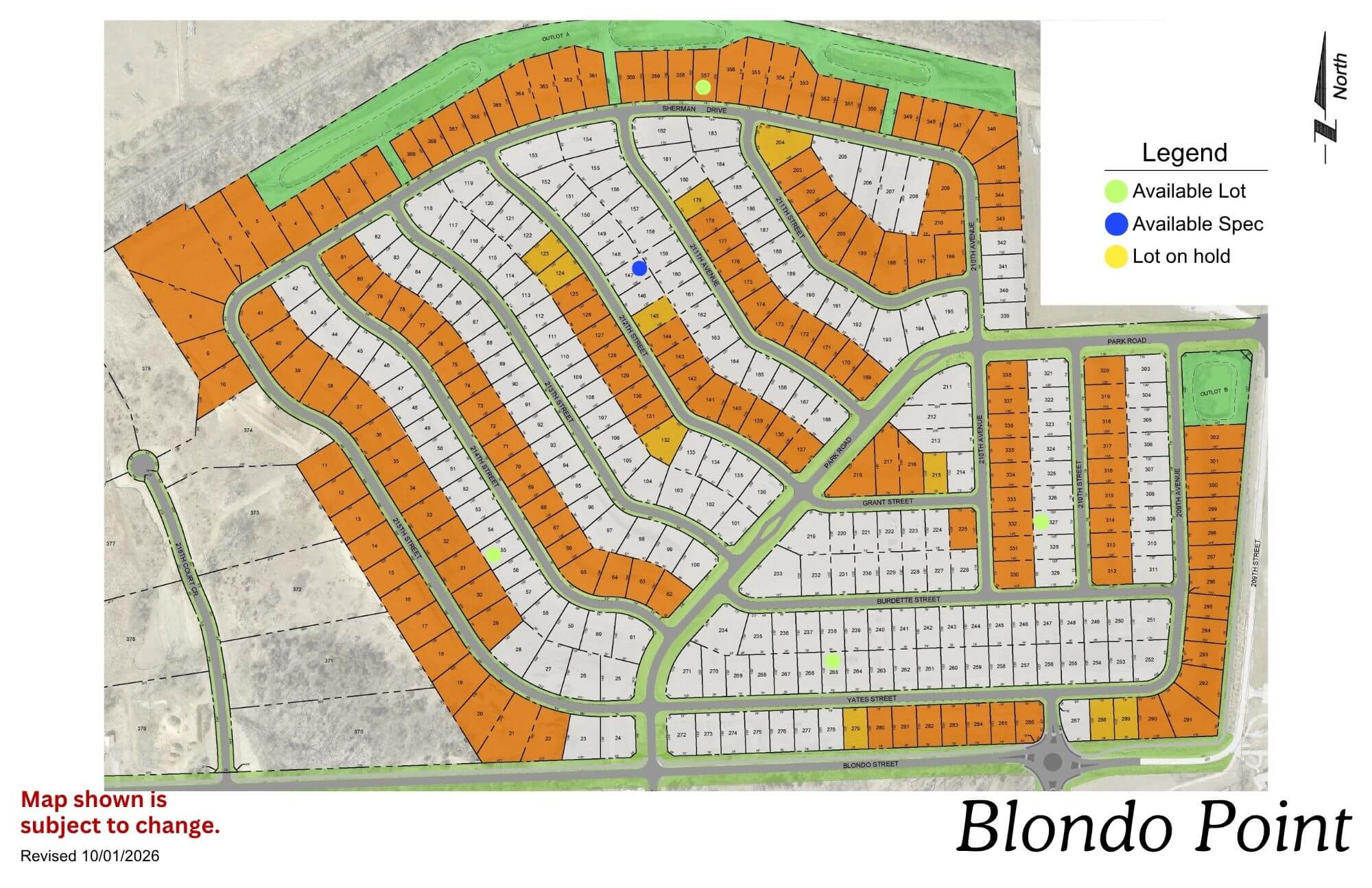
Blondo Point

Blondo Point residential development map showing street layout and lot divisions in orange and white
Click to enlarge

Location: 214th St & Blondo St

School District: Elkhorn

Amenities:

  • 1 Minutes from the West Dodge Expressway

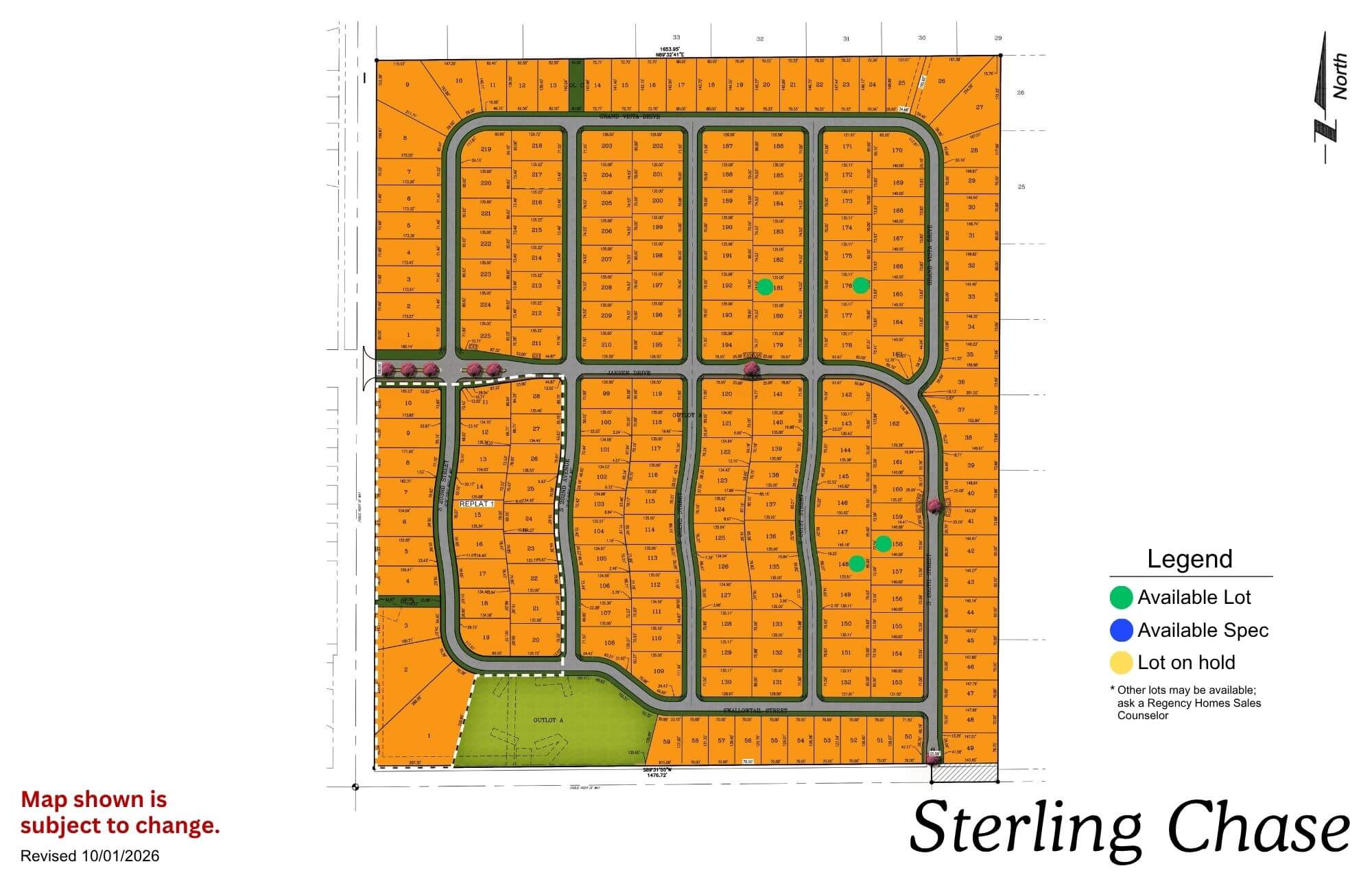
Sterling Chase

Sterling Chase residential subdivision map showing street layout and lot divisions in orange with green space areas
Click to enlarge
Sterling Chase logo featuring a silhouette of a running horse with circular design elements and text

Location: 204th & Capehart Rd

School District: Gretna

Amenities:

  • Across from the new YMCA
  • Gretna Crossing nature park
  • Dog park

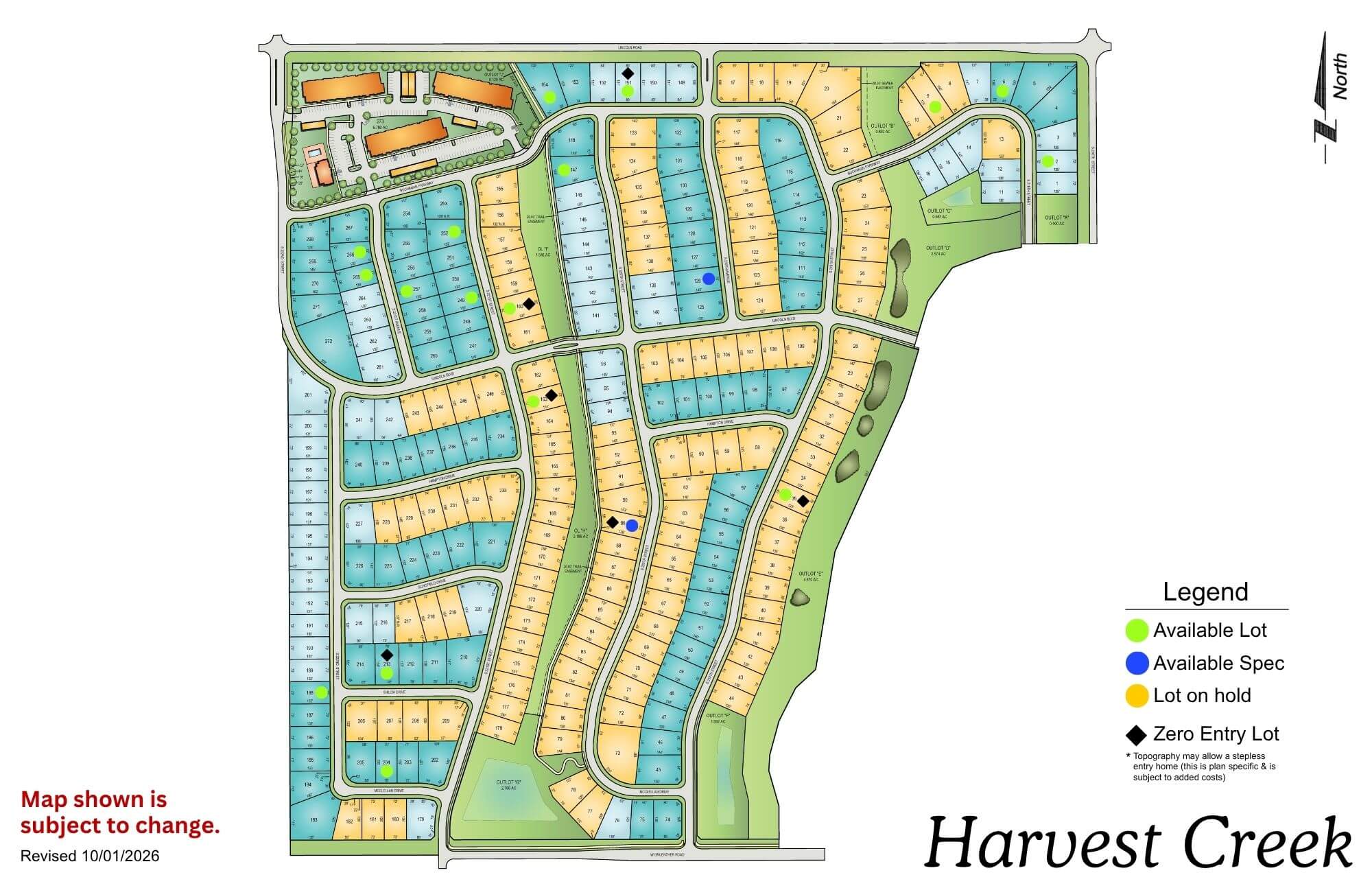
Harvest Creek

Harvest Creek residential development map showing street layout, lot divisions, and green spaces with legend
Click to enlarge
flagged_for_blc_image_alt_generator

Location: 216th & Lincoln Rd

School District: Gretna

Amenities:

  • Green Space

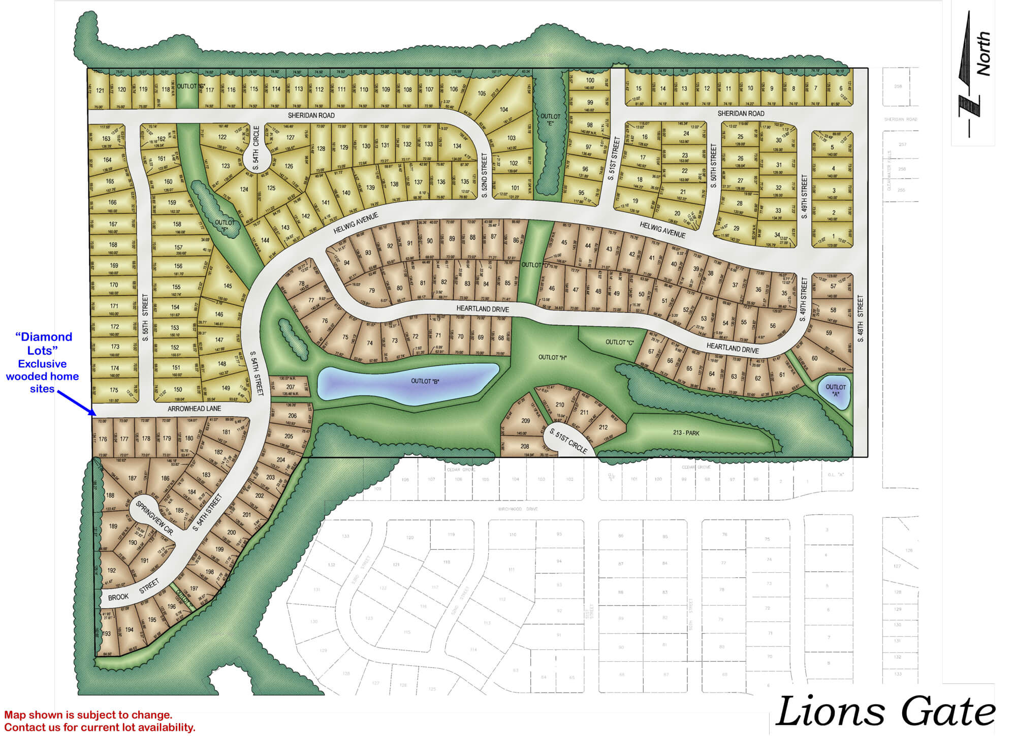
Lions Gate

Detailed neighborhood map showing Lions Gate residential development with streets, house lots, green spaces, and water
Click to enlarge
Falling Water residential community entrance sign with stone base and houses visible in background

Location: 198th & Harrison St

School District: Gretna

Amenities:

  • Close to easy access traffic ways, established neighborhood, close day care centers, and several places of worship.
  • Oversized lots – many 82’ wide lots.
  • Minutes to West Dodge traffic way, the 180th & Center shopping mile, the I-80 interstate system, and to grocery and other shopping services.

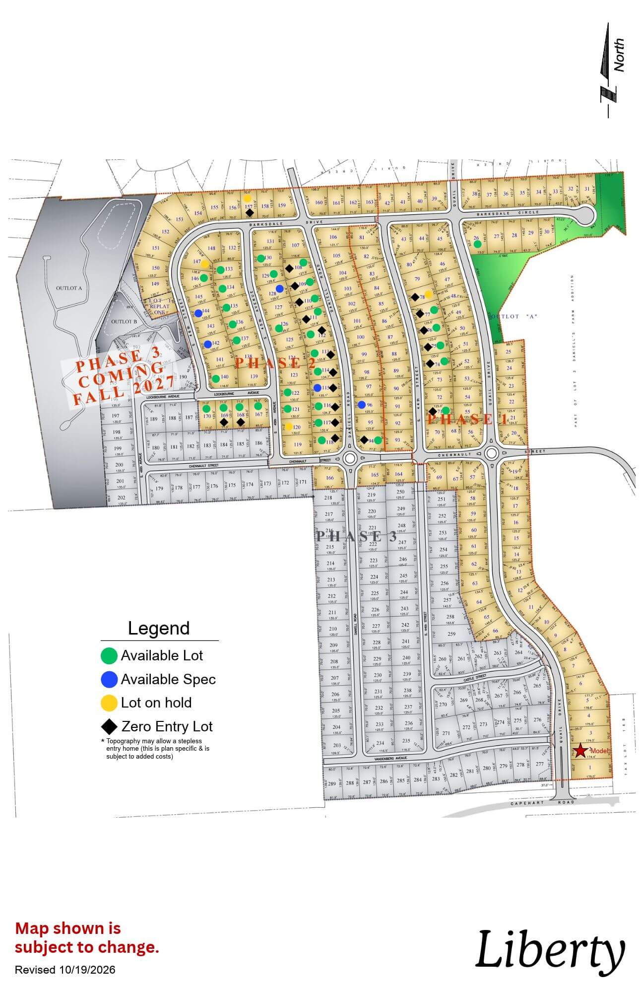
Liberty

Liberty subdivision map showing planned residential lots, roads, and green spaces with north orientation
Click to enlarge
flagged_for_blc_image_alt_generator

Location: 43rd & Capehart Rd

School District: Bellevue

Amenities:

  • Treed and nature reserve lots available
  • 11 minutes from Shadow Lake Towne Center
  • 15 minutes from Offutt Air Force Base

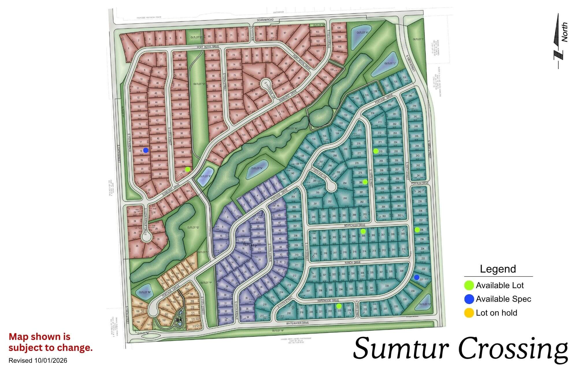
Sumtur Crossing

Sumtur Crossing neighborhood map showing residential streets, parks, and green spaces in a planned community layout
Click to enlarge
Sumtur Crossing entrance sign with landscaping and trees in background

Location: 114th & Schramm Rd

School District: Papillion La Vista

Amenities:

  • Close to Sumtur Amphitheater (concerts, movies and plays)
  • Adjacent to the 450 acre Walnut Creek Recreation area with its 105 acre lake (hiking, biking and fishing)

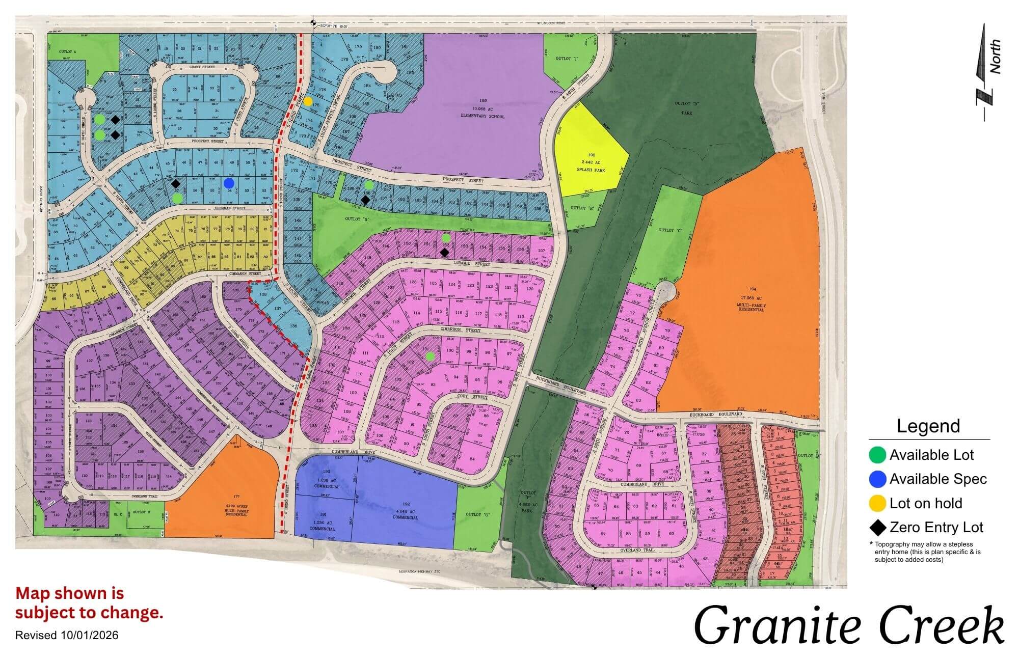
Granite Creek

Granite Creek community map showing colored residential sections, streets, and amenities with legend
Click to enlarge
Granite Creek logo with sun, evergreen trees, and blue sky sunset background

Location: 108th & Lincoln Rd

School District: Papillion La Vista

Amenities:

  • Adjacent to the proposed NRD lake area
  • Close to Sumtur Amphitheater (concerts, movies and plays)
  • Close to the 450 acre Walnut Creek Recreation area with its 105 acre lake (hiking, biking and fishing)
  • Close to Werner Ball Park – Home of the Omaha Storm Chasers

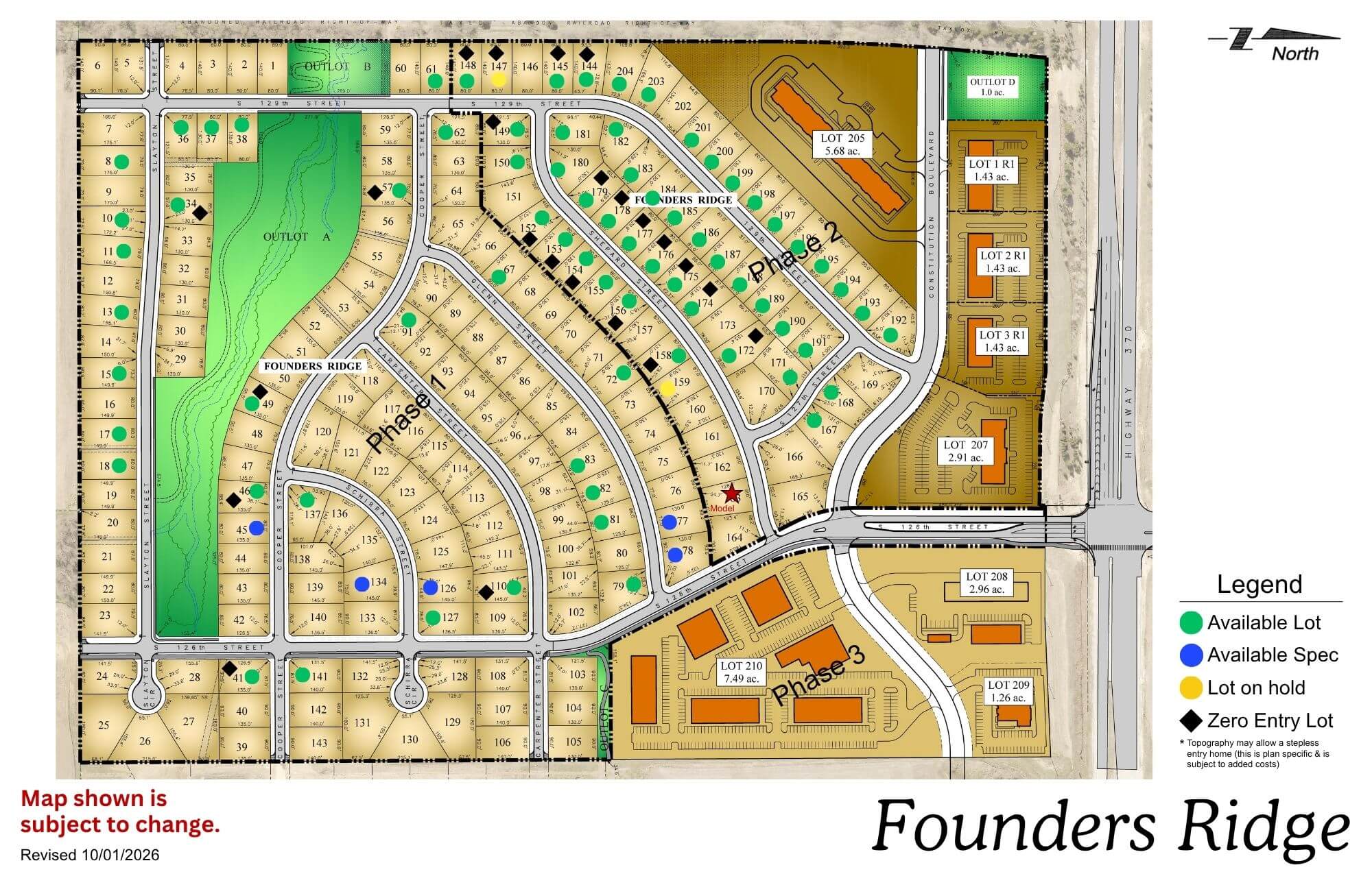
Founders Ridge

Founders Ridge residential community map showing street layout, lots, and amenities including green spaces and legend
Click to enlarge
Wooden Founders Ridge sign with evergreen trees and landscaping in background

Location: 126th & Hwy 370

School District: Papillion La Vista

Amenities:

  • Adjacent to Prairie Queen Lake and Recreation Area-hiking, biking and fishing
  • Adjacent to Werner Ball Park – Home of the Omaha Storm Chasers
  • Minutes to the I-80 Interstate system
  • Enjoy the Sumtur Amphitheater for concerts, movies and plays, the Shadow Lake Towne Center shopping, and the Walnut Creek Recreation and lake area for hiking, biking and fishing

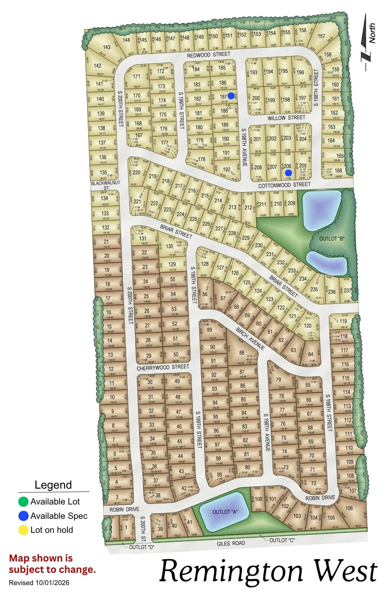
Remington West

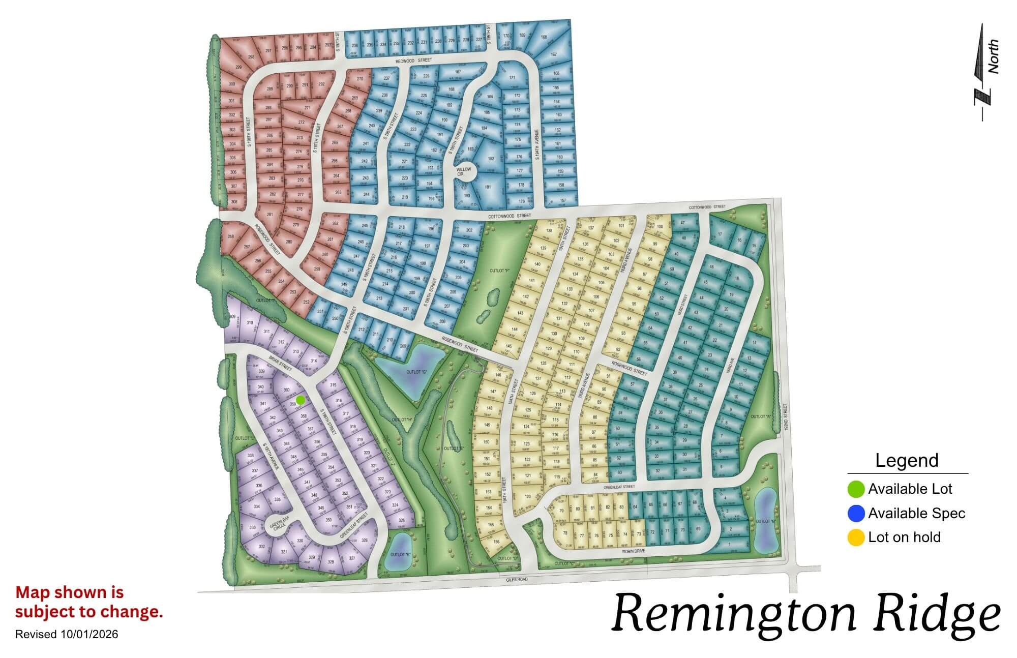
Remington West residential subdivision map showing street layout, lot divisions, and amenities including parks and water
Click to enlarge
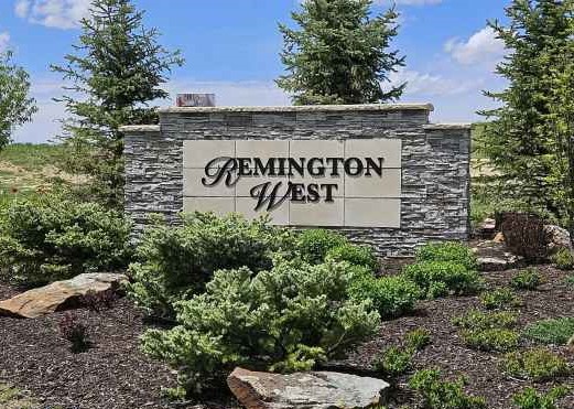
Remington West stone entrance sign with landscaping and evergreen trees

Location: West of Remington Ridge (South of Harrison on 192nd St)

School District: Gretna

Amenities:

  • Trails and Nature reserve

Remington Ridge

Remington Ridge neighborhood map showing colored sections for available lots and different residential areas
Click to enlarge
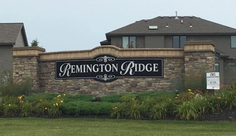
Remington Ridge residential community entrance sign with stone base and landscaping in front of houses

Location: South of 192nd & Harrison St

School District: Gretna

Amenities:

  • Trails and Nature reserve

Bridgeport

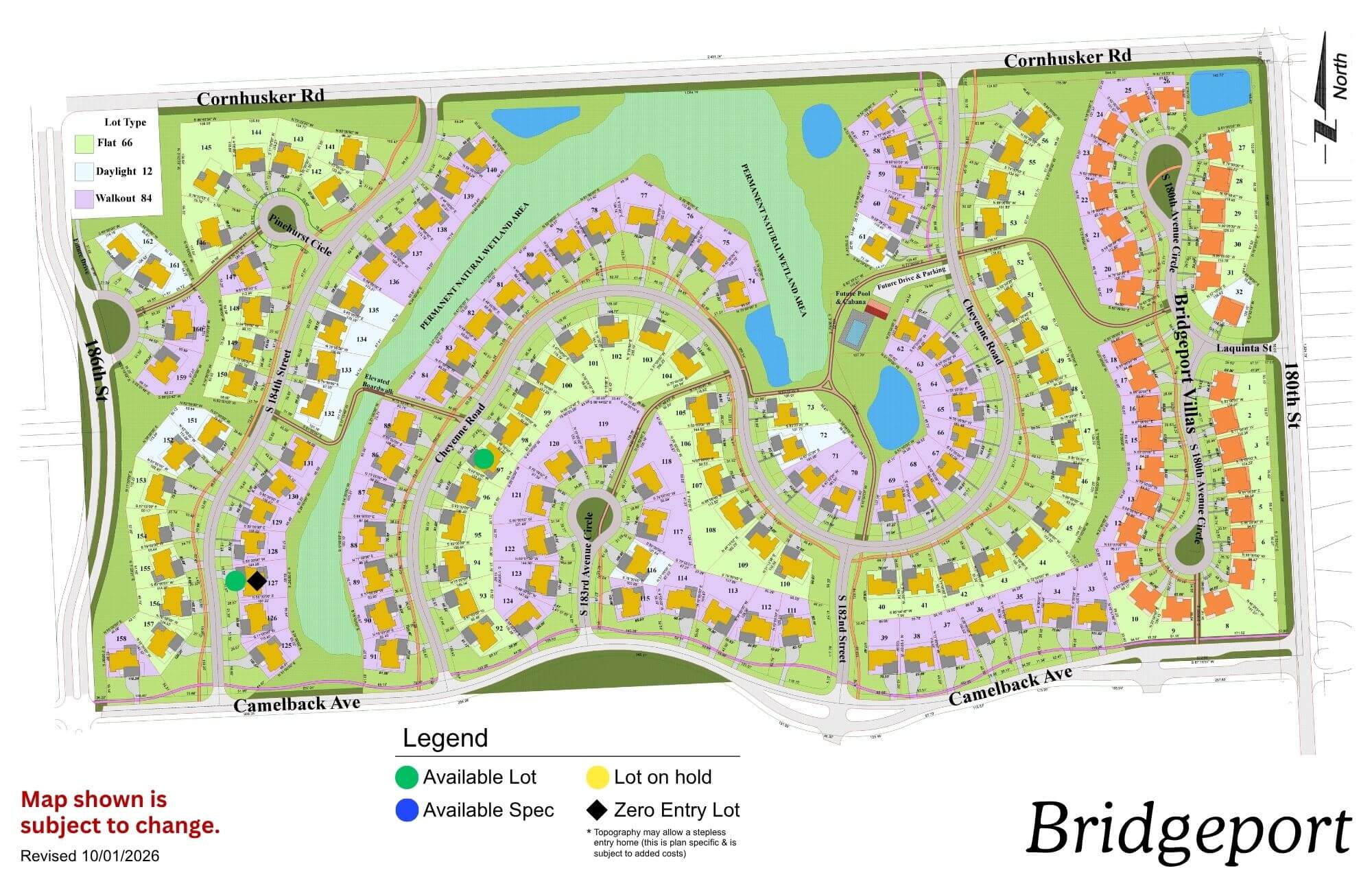
Bridgeport community map showing residential streets, green spaces, and planned development areas with legend
Click to enlarge
Bridgeport logo with blue text and stylized feather icon

Location: 180th St & Cornhusker Road

School District: Gretna

Amenities:

  • Coved, park-like streetscape
  • Extensive green space and trail network
  • Community Swimming Pool

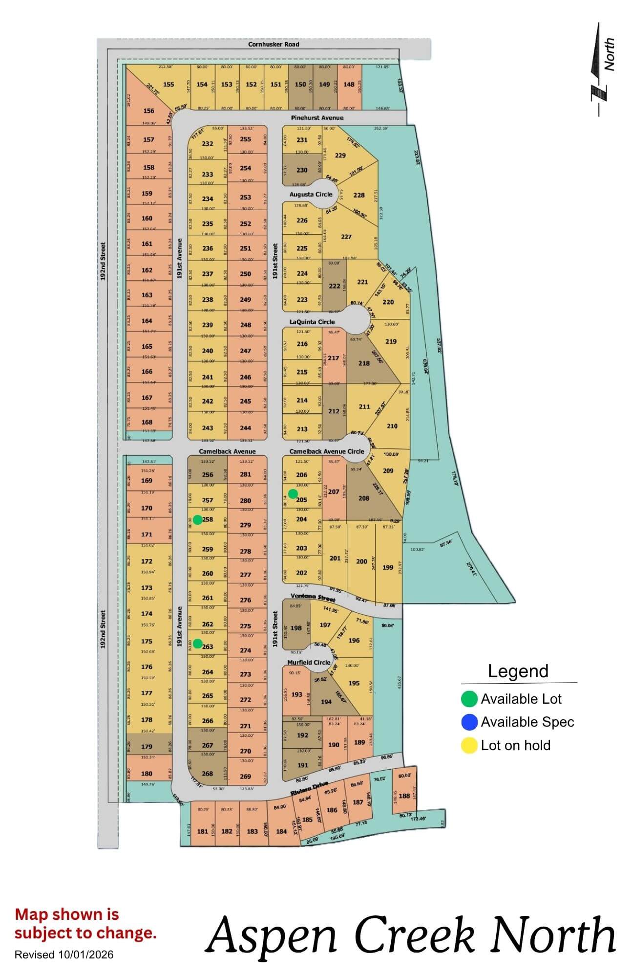
Aspen Creek North

Aspen Creek North community map showing lot layouts and street names
Click to enlarge
Aspen Creek North Phase 2 logo with orange circles and gold text on blue background

Location: 1 mile N of 192nd & Hwy 370

School District: Gretna

Amenities:

  • Adjacent to the all-new Gretna school campus facility

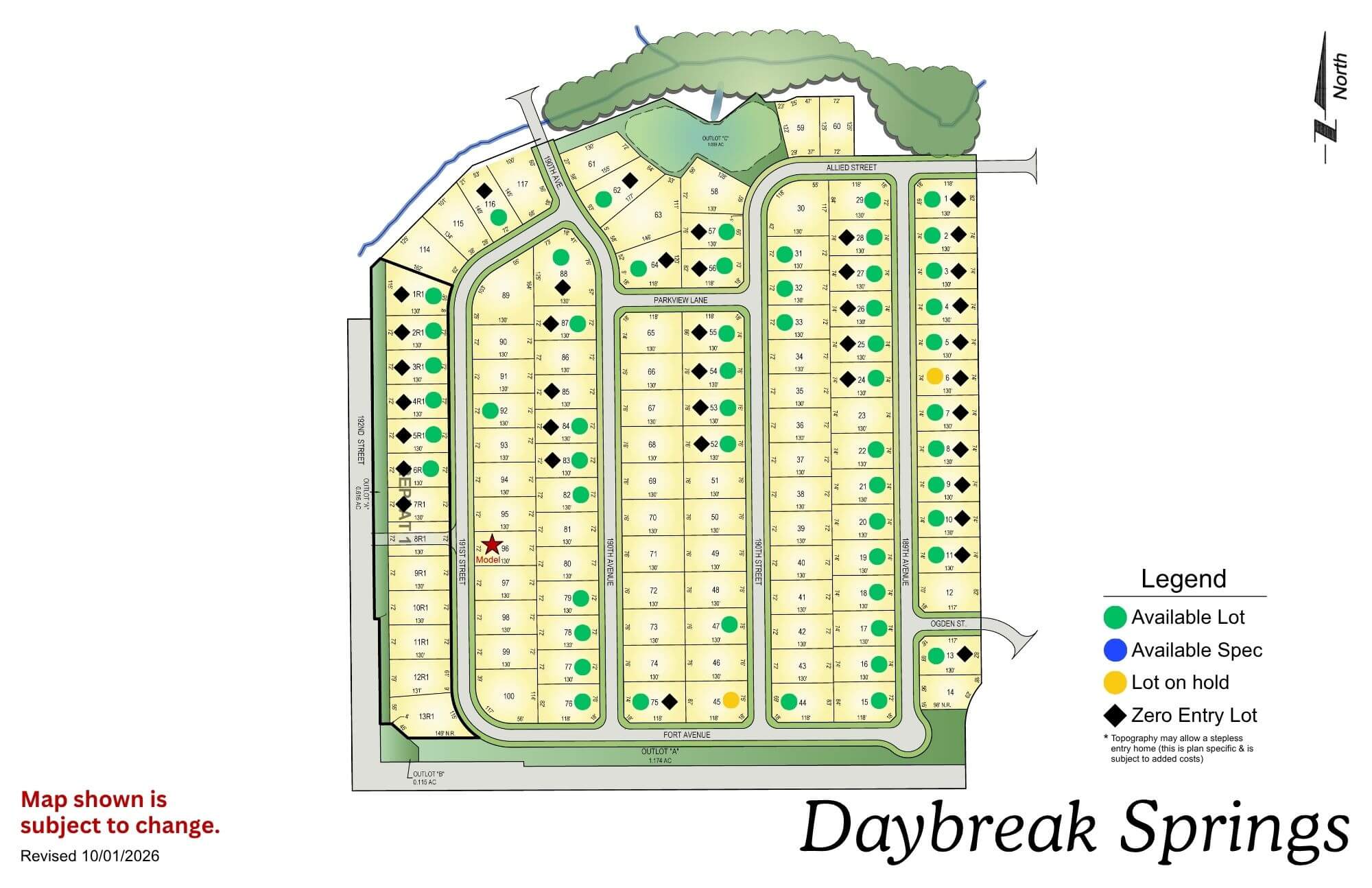
Daybreak Springs

Daybreak Springs residential community map with streets, lots, and legend showing amenities and facilities
Click to enlarge
Daybreak Springs logo with blue cursive text and a yellow sun graphic

Location: 192nd St & Fort St

School District: Elkhorn

Amenities:

  • Access to green space
  • Nearby Golfing
  • Adjacent to the Fort Street Improvement Project

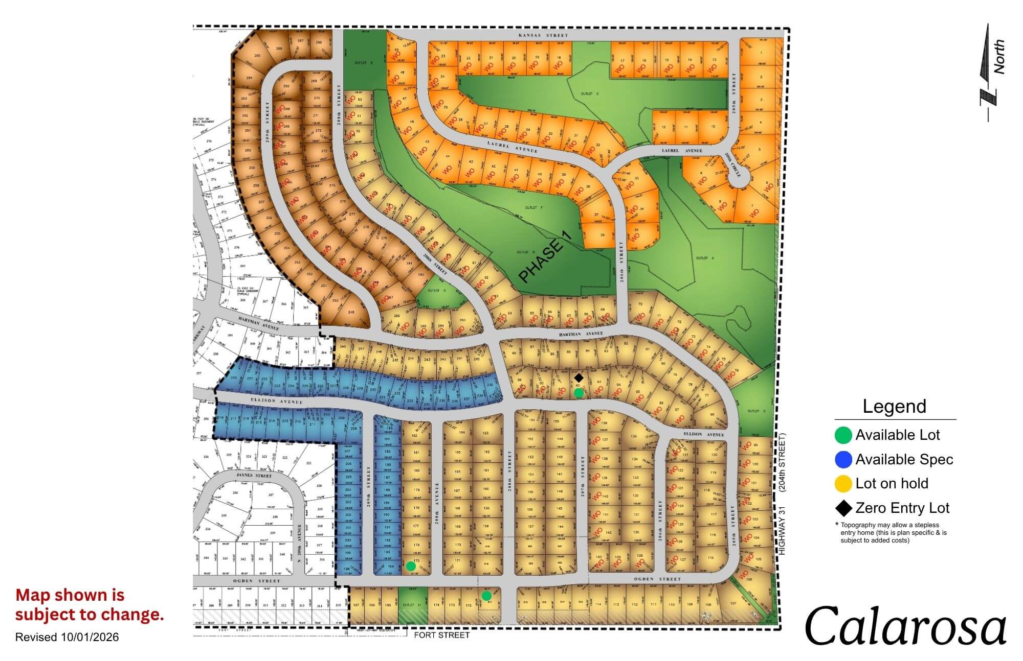
Calarosa

Calarosa residential community map showing streets, lots, and green spaces with legend
Click to enlarge
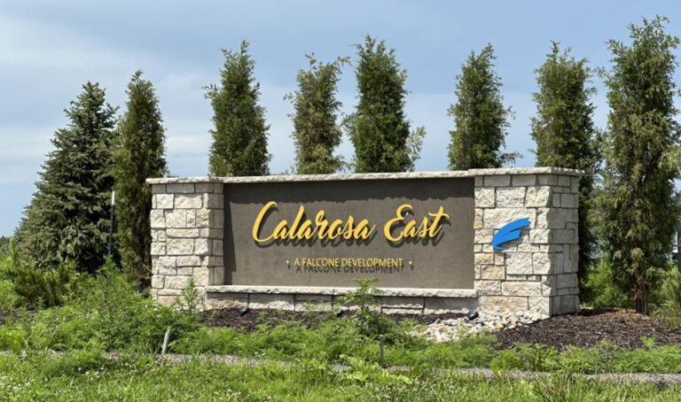
Calarosa East monument sign with stone base and evergreen trees in background

Location: 204th St and Fort St

School District: Elkhorn

Amenities:

  • 3 miles from Maple St Shopping Corridor

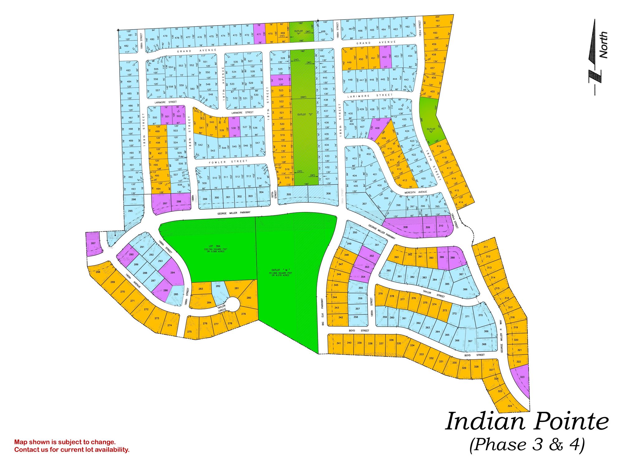
Indian Pointe

Indian Pointe Phase 3 & 4 residential development map showing street layout and colored lot divisions
Click to enlarge
Falling Water residential community entrance sign with stone base and houses visible in background

Location: 198th & Harrison St

School District: Gretna

Amenities:

  • Close to easy access traffic ways, established neighborhood, close day care centers, and several places of worship.
  • Oversized lots – many 82’ wide lots.
  • Minutes to West Dodge traffic way, the 180th & Center shopping mile, the I-80 interstate system, and to grocery and other shopping services.

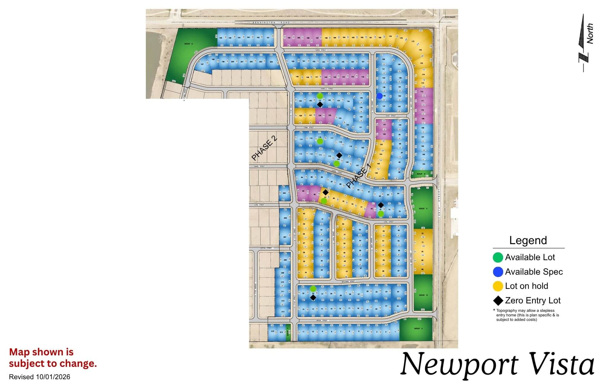
Newport Vista

Newport Vista map showing residential streets, lots, and legend with color-coded categories
Click to enlarge
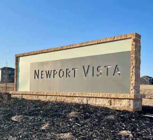
Newport Vista community sign with tan background and brown border against clear blue sky

Location: North 168th Street and Bennington Road

School District: Bennington

Amenities:

  • View lots
  • Bennington school across the street
  • Adjacent to a nature reserve
  • View of Bennington Lake

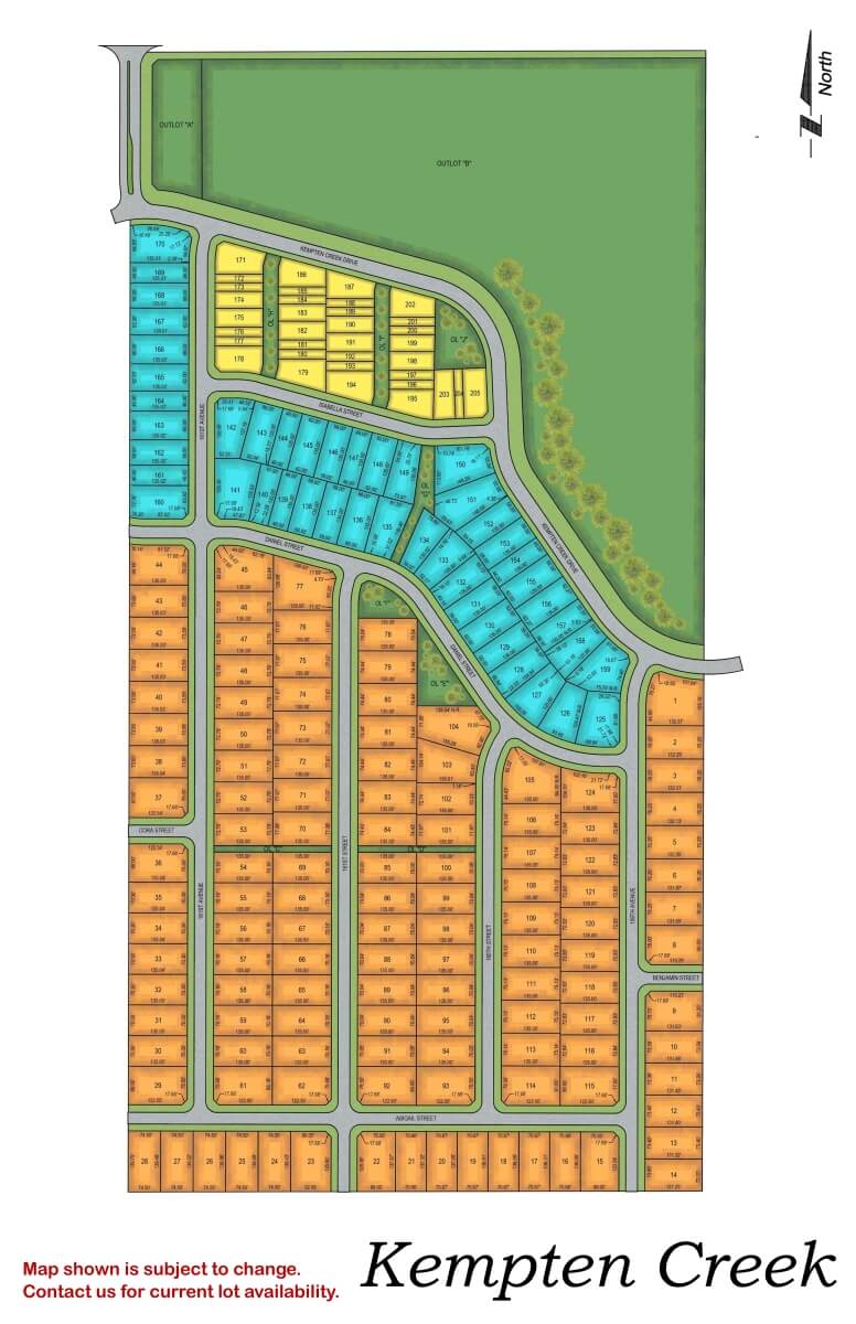
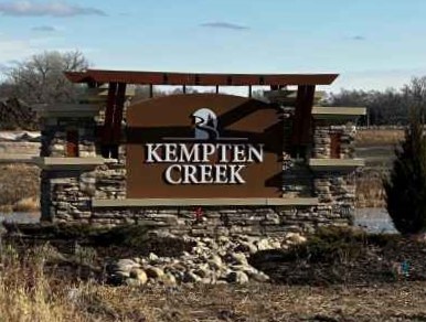
Kempten Creek

Kempten Creek residential subdivision map showing street layout and lot divisions in orange and blue sections
Click to enlarge
Wooden entrance sign for Kempten Creek with stone base and metal frame against rural landscape

Location: 165th Street and Bennington Road

School District: Bennington

Amenities:

  • View lots
  • Adjacent to regional park

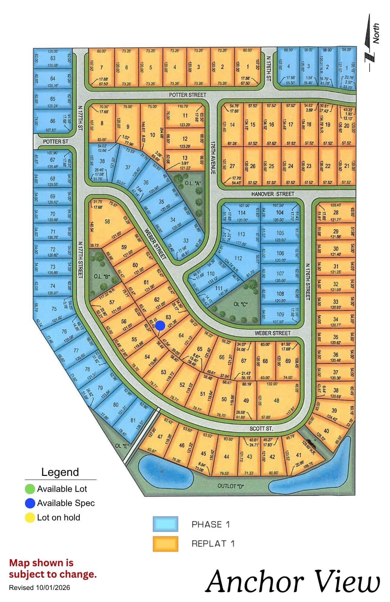
Anchor View

Anchor View residential community map showing lot layouts, streets, and available parcels in yellow and blue sections
Click to enlarge
Anchor View logo with navy anchor and rope design in circle with text below

Location: 3 blocks N of 168th Ida

School District: Elkhorn

Amenities:

  • Overlooks Flanagan Lake, a 220-acre lake with 730 acres of recreation
  • Public access Flanagan Lake as well as facilities for boat access
  • Blocks of walking & biking trails
  • Playgrounds and youth sport fields

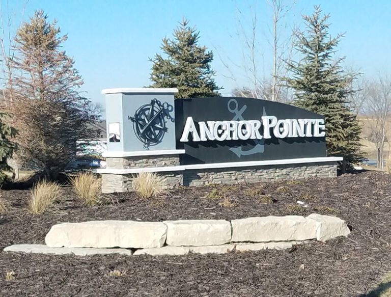
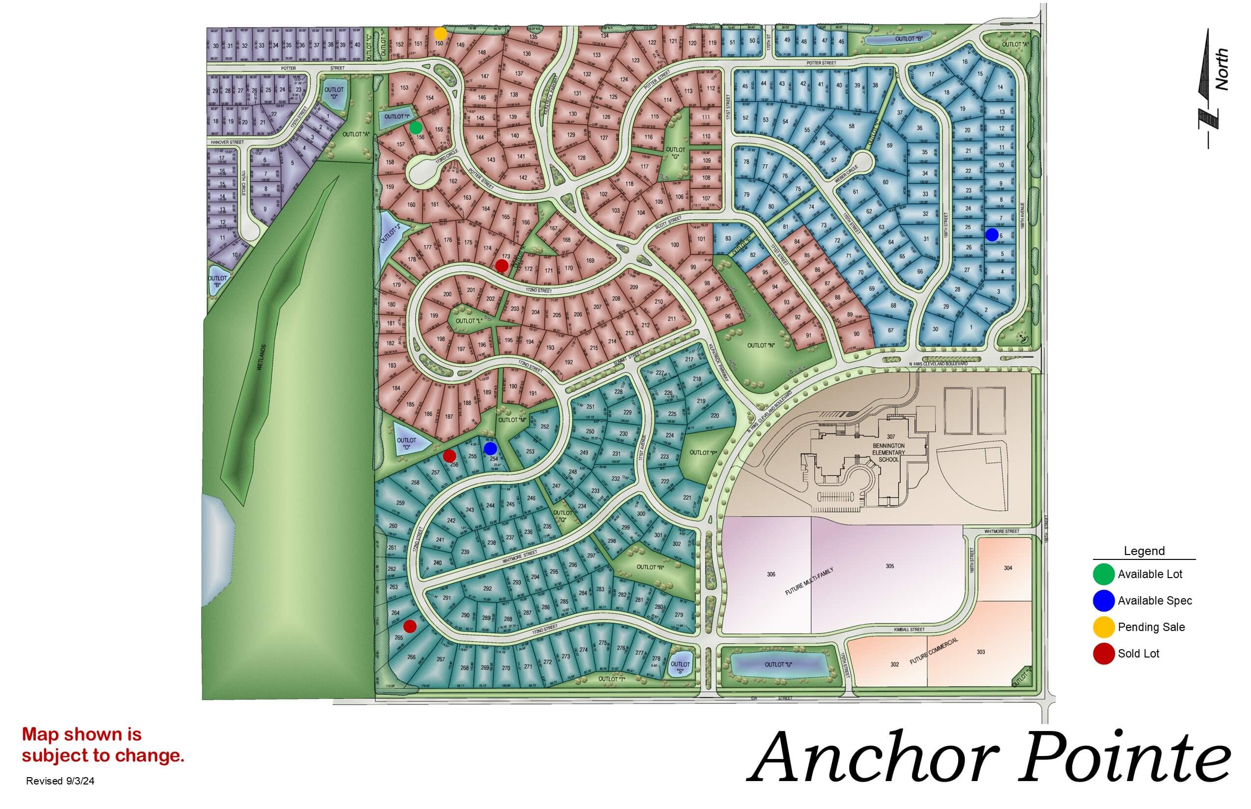
Anchor Pointe

Anchor Pointe development map showing residential streets, green space, and community layout with color-coded zones
Click to enlarge
Anchor Pointe sign with large boulder in front and evergreen trees in background

Location: 198th & Harrison St

School District: Gretna

Amenities:

  • Close to easy access traffic ways, established neighborhood, close day care centers, and several places of worship.
  • Oversized lots – many 82’ wide lots.
  • Minutes to West Dodge traffic way, the 180th & Center shopping mile, the I-80 interstate system, and to grocery and other shopping services.

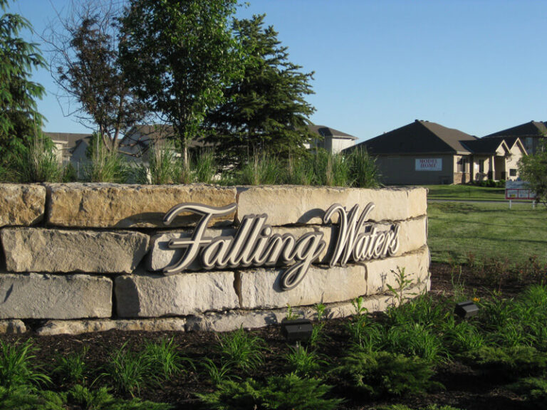
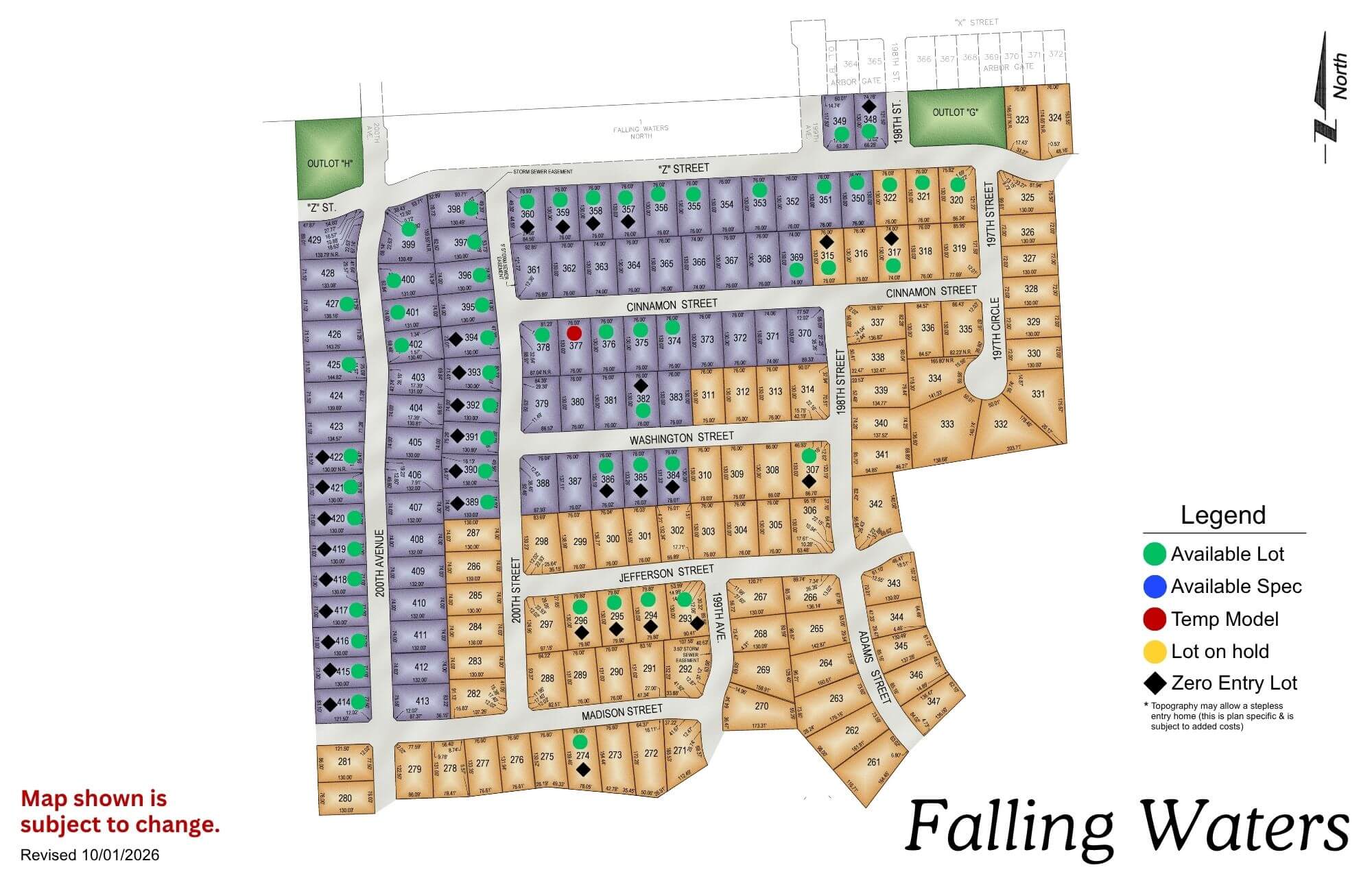
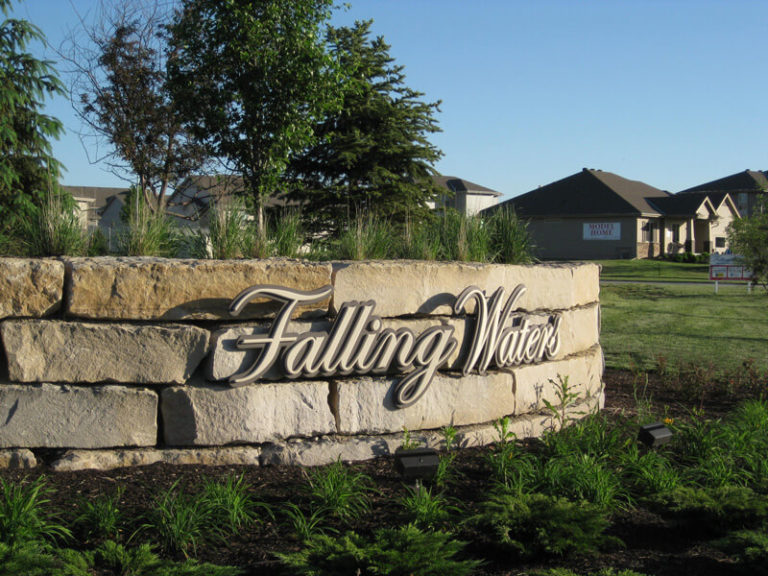
Falling Waters

Falling Waters residential development map showing colored lot sections with legend and street layout
Click to enlarge
Falling Water subdivision entrance sign with stone base and manicured lawn, residential neighborhood buildings visible in

Location: 198th & Harrison St

School District: Gretna

Amenities:

  • Close to easy access traffic ways, established neighborhood, close day care centers, and several places of worship.
  • Oversized lots – many 82’ wide lots.
  • Minutes to West Dodge traffic way, the 180th & Center shopping mile, the I-80 interstate system, and to grocery and other shopping services.
Avatar
Sarah contacted us to discuss a project
Avatar
Jiten contacted us to discuss a project
Avatar
Ella contacted us to discuss a project
Avatar
Lisa contacted us to discuss a project
Avatar
Matthew has downloaded our Planning Guide
Avatar
Rick contacted us to discuss a project